Sub-seasonal Outlooks
Roughly week 2 through week 6. Skill is low, so read these as shifts in the odds toward warmer or colder, wetter or drier than normal, not as a day-by-day forecast.
ECMWF extended range (weekly averages)
The ECMWF ensemble run out to about six weeks, shown as weekly averages for the sub-seasonal range (weeks 2 to 6). Pick a week to compare precipitation, temperature and the 500 hPa pattern side by side, or pick a product to compare the weeks.
Loading the ECMWF charts…
Climate Prediction Center (NOAA)
The CPC 6–10 and 8–14 day outlooks show the probability of above or below normal temperature and precipitation. Colors show the favored category and how strongly, not how much.
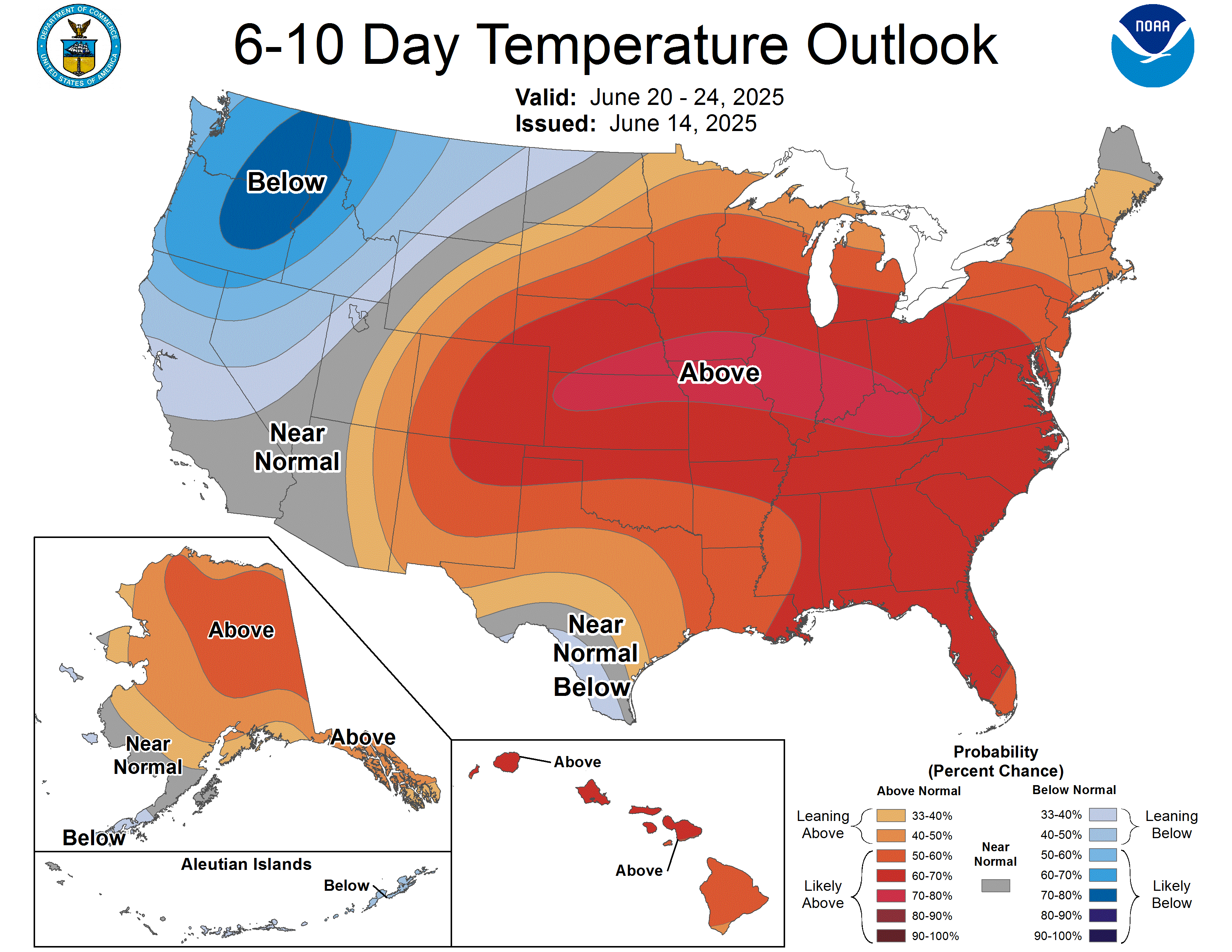
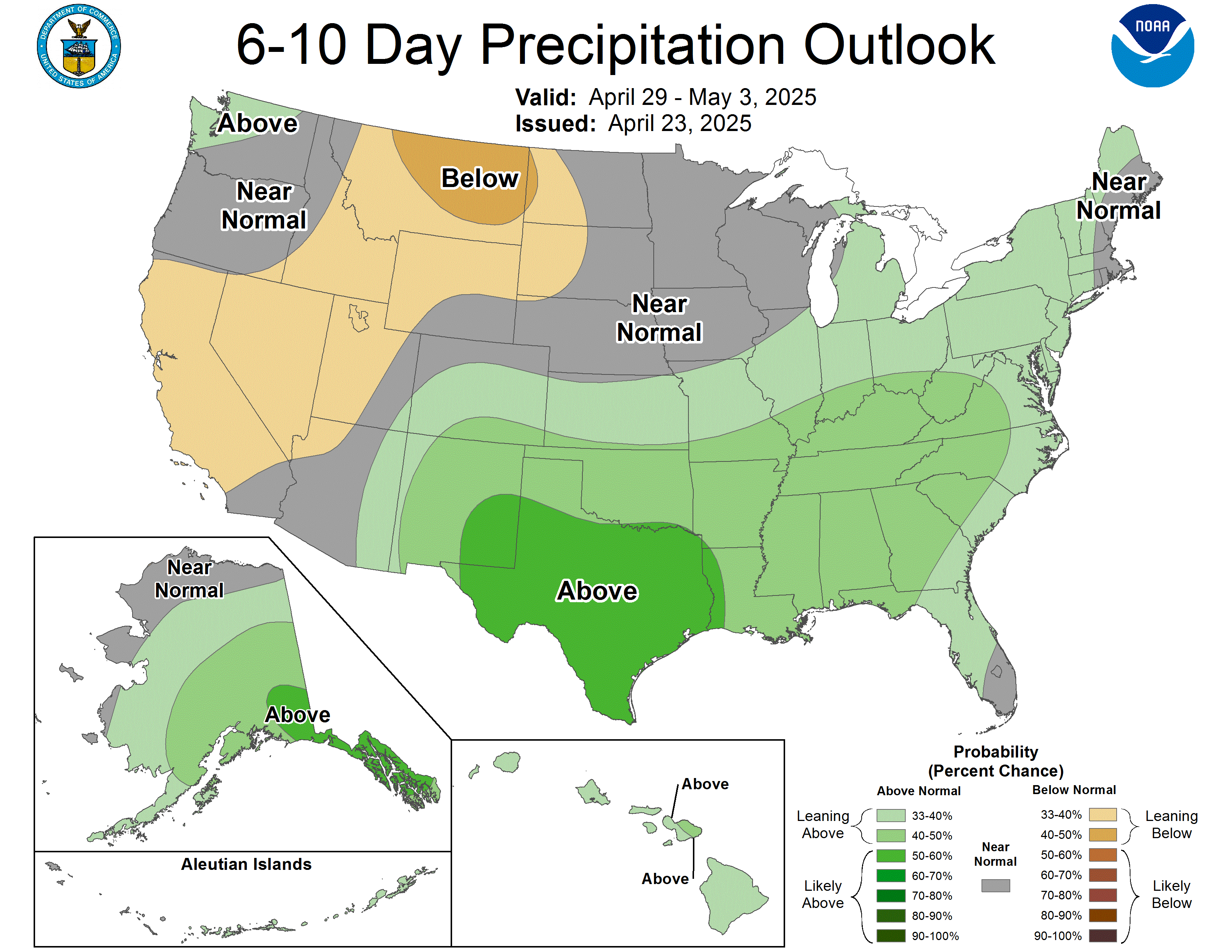
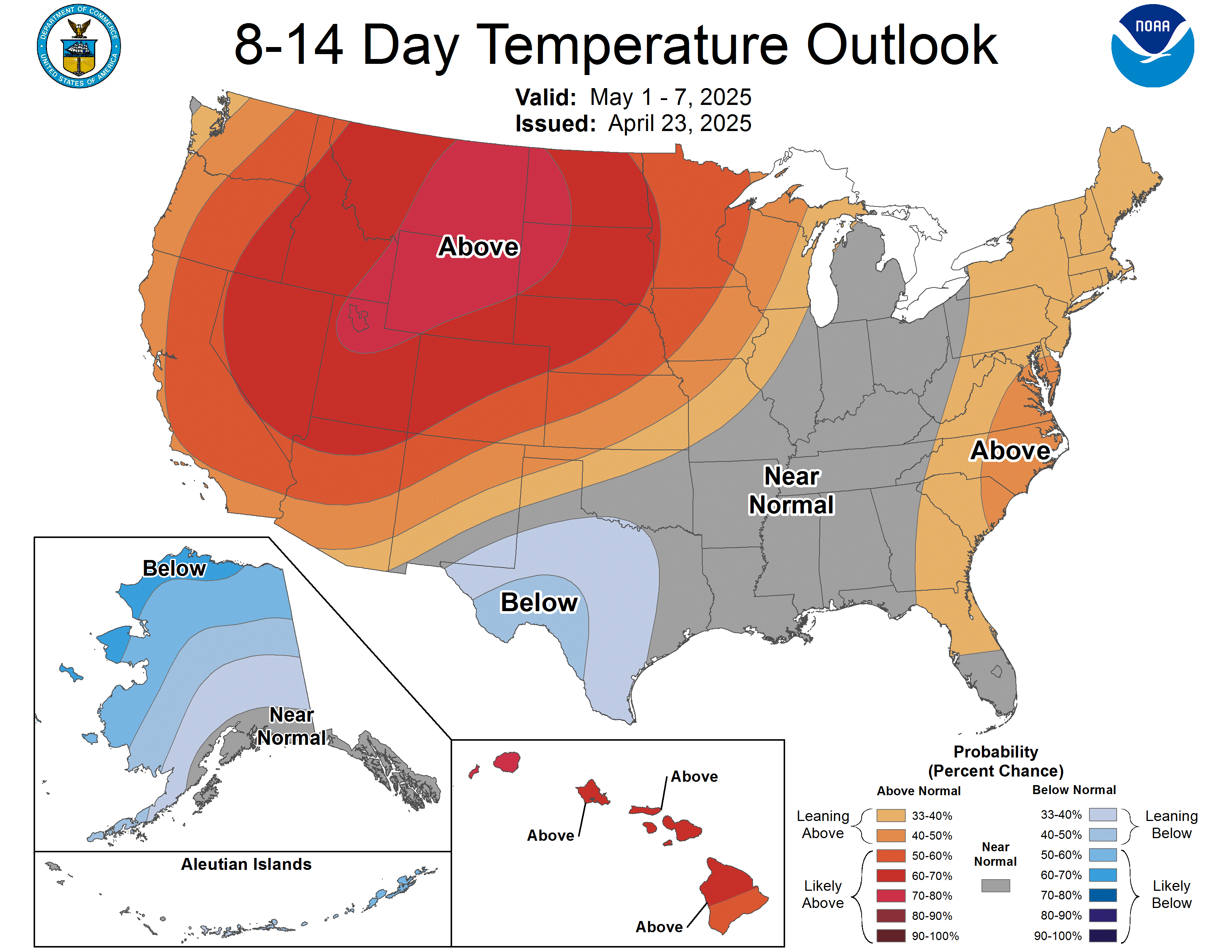
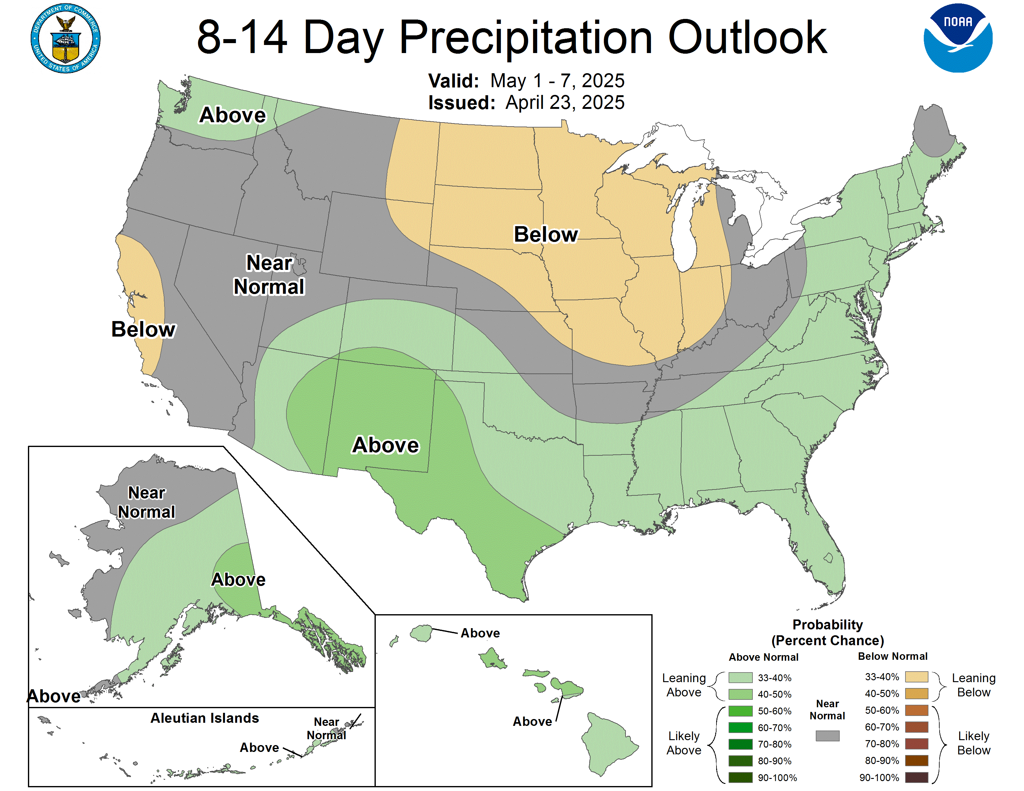
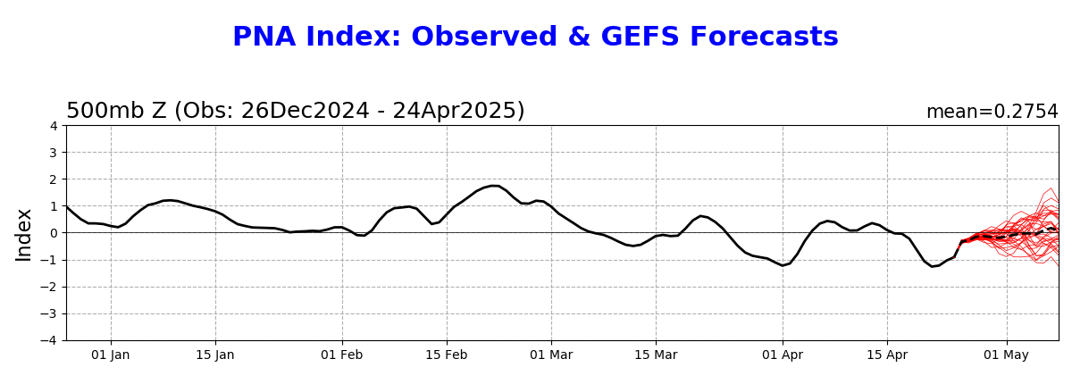
Source: NOAA Climate Prediction Center. PNA forecast: CPC. Also see the week 3–4 outlook.
Weather regimes (CW3E and IRI)
Instead of forecasting each storm, regime forecasts ask which large-scale pattern, such as a Pacific trough or a West Coast ridge, is most likely over the coming weeks, and what each pattern usually means for Northwest precipitation and temperature. Updated every Wednesday.
Loading the weather regime figures…
Sources: CW3E, UC San Diego and IRI, Columbia University. CW3E also posts a weekly subseasonal outlook write-up.
What we plan to add
Our summary
A short weekly note in plain language: what the outlooks agree on, where they disagree, and what it could mean for the snowpack.