
In this week's edition of the Dendritic Growth Zone Forecast Blog what's that?
We've been on a cold-air diet, but can we expect a Thanksgiving feast?
Cold air sticks around for the weekend with a weak storm Sunday before things get interesting Thanksgiving week.
🎯 The Short Version
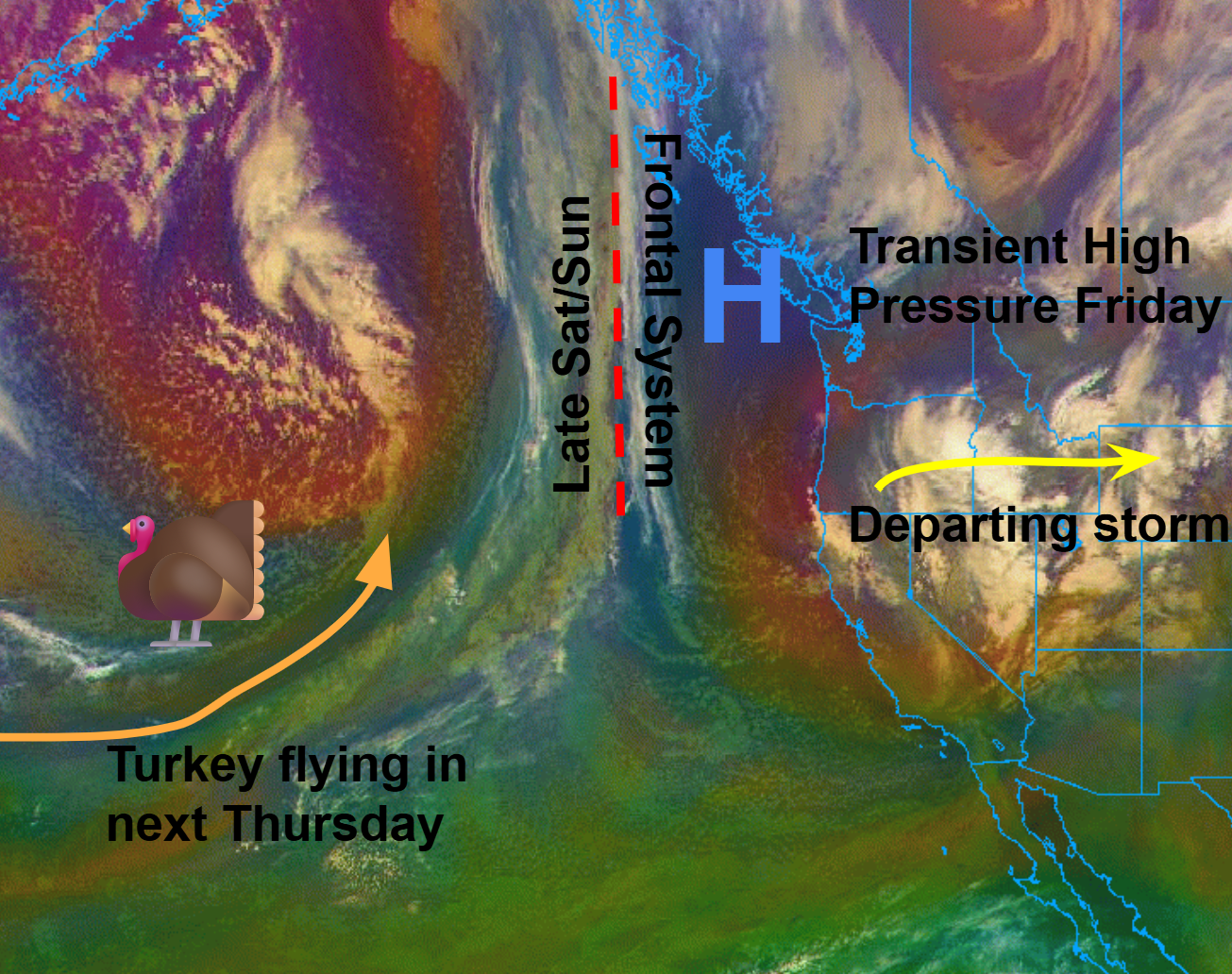
A transient ridge builds Friday, keeping cold air in place and partly cloudy skies. A weak storm is expected to arrive Saturday evening before a more powerful storm comes through early next week. I sound like a broken record, but head out Saturday morning/early afternoon for some chilly trails and potential sun breaks.
📑 Contents
1. Past Week Recap
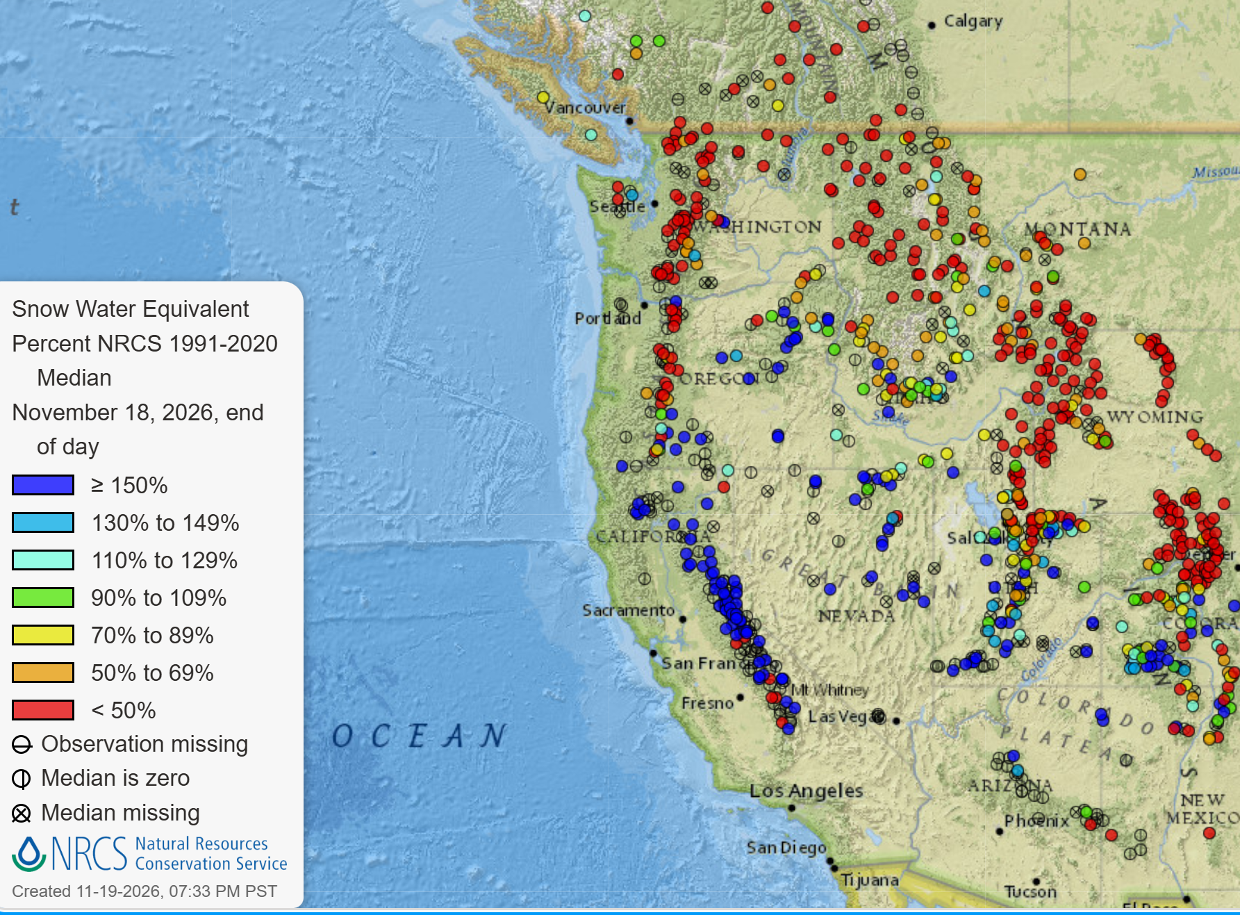
Much of the West got an early Thanksgiving feast, with the Sierra Nevada and Wasatch the big winners, with SNOTEL sites in those regions showing multiple inches of snow water equivalent (see picture below). Washington has been on a cold-weather diet: plenty of cold air, little snow. Freezing levels of 2,500-4,000 ft meant everything that fell in the mountains was snow, but totals were small and concentrated in the south and, unusually, on the east side of the Cascades.
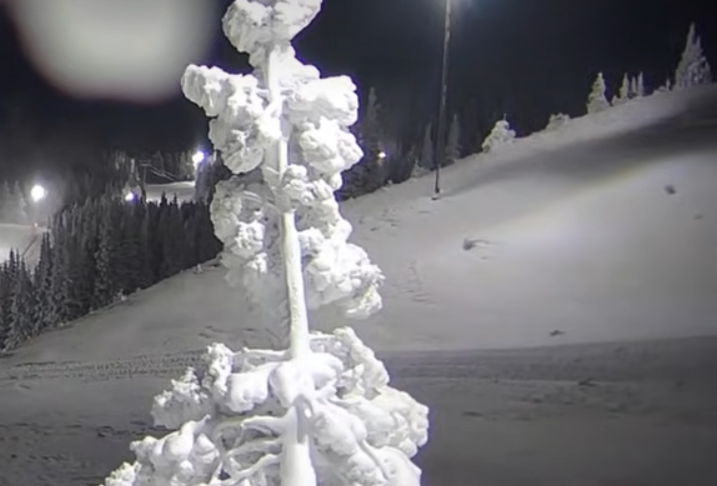
A low-pressure system sat just off the California-Oregon coast. Because lows rotate counterclockwise, its 500 mb flow (~18,000 ft) wrapped northeasterly across Washington, carrying cool, moderately moist air toward the east slopes. Mission Ridge came out with 9", well ahead of Stevens Pass with about 3".
- How last week's forecast did: Last weekend was a mixed bag. We were too optimistic at Baker (6 forecast, 2 observed), Paradise (6 vs 3) and Crystal (3 vs 1). The NBM missed White Pass entirely (0) and was low at Baker and Stevens. Overall we landed within about 1.5 inches on average, about the same as the NBM, and inside the observed range at 6 of 9 areas; full scoring is on the evaluation page.
🧰 Related tools: Live conditions mapSatellite loopForecast evaluation
2. Synoptic (Large-Scale) Overview
The low is dissipating as a ridge builds through Friday. With clear skies and long nights, expect cold valley fog slow to clear, plus inversions that leave valleys colder than the higher terrain. Some lingering moisture could keep clouds over the mountains. Saturday morning looks much the same.
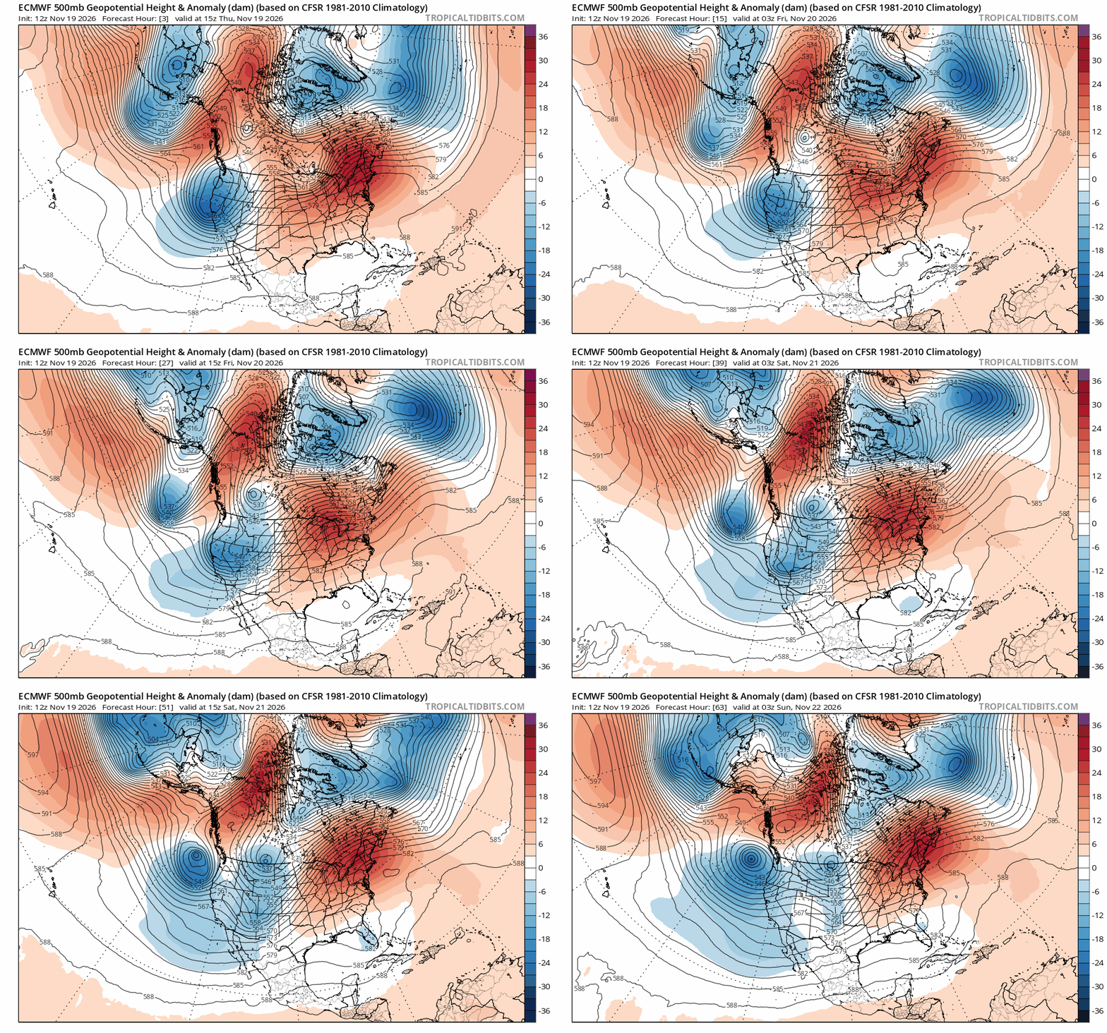
A weaker system to the south pinches off the ridge and approaches the coast, bringing a weak cold front. Freezing levels stay below pass level, so precipitation falls as snow, but these systems are moisture-starved. Don’t expect much accumulation.
- Pattern: Transient ridge builds Friday and is pinched off by a weak low pressure system late Saturday
- Key features this weekend: Cold surface temperatures Friday and Saturday, with potential for lowland rain/mountain snow late Saturday into Sunday.
- Model agreement: Near-term is confident, but the orientation and impact of this weak system are still uncertain. Just how much precipitation it will drop remains to be constrained.
🧰 Related tools: Upper Air and Surface WeatherSatellite loopSkew-T / soundings
3. Local Overview
The early part of this weekend will be a great chance to close out your Fall leaf-peeping (for whatever is left). Sunday's system will bring periodic snow showers that progress from the southwest to northeast, with snow totals concentrated in the southern volcanoes, Wenatchee Mountains, and Olympics.
- Friday: Cool temperatures with potential for valley fog.
- Saturday: Similar conditions to Friday, but with increasing cloud cover over the day. Possible rain/snow in PM progressing from Southwest to Northeast.
- Sunday: Cold front passes overnight, so scattered snow showers are possible Sunday.
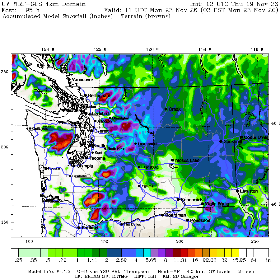
Snow level & temperatures
Freezing levels will start out around 3000-4000' and descend towards 2500' over the weekend. They will rise slightly during the mid-day hours.
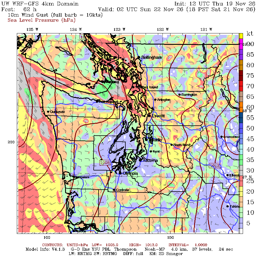
Winds
Winds will be light to moderate for much of the early parts of the weekend. Expect winds to increase later Saturday with the approaching system. Winds will be strongest along the Cascade Crest, Strait of Juan de Fuca, North Puget Sound, and Coastline.
🧰 Related tools: PrecipitationFreezing & snow levelLowland snowSkew-T / soundings
4. Snow Forecast: Map, Plumes and Table
Click a location on the map (or its name below it) to see that site's snowfall and liquid precipitation plumes and its snow table. Sites are colored by their weekend total.
🧰 Related tools: Precipitation toolsFreezing & snow levelSki model meteograms
5. Weekend Winners (and Losers)
🏆 Winners
- Mission Ridge: The favorable setup from the storm this past week, along with great snow-making conditions means Mission Ridge is preparing itself for a good start to the season!
🥀 Losers
- Washington Skiing Right Now: I'm jealous of our powder compatriots to the south
Best bet this weekend: For a longer drive, check out Mission Ridge to see how things are progressing. But ensure you check their website for updates to their uphill travel policy. Otherwise, stick to ripping a good trail run or ride while still accessible.
🧰 Related tools: Powder Stash PredictorPrecipitation tools
6. Mid-Range (Early Next Week)
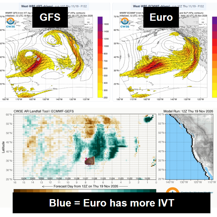
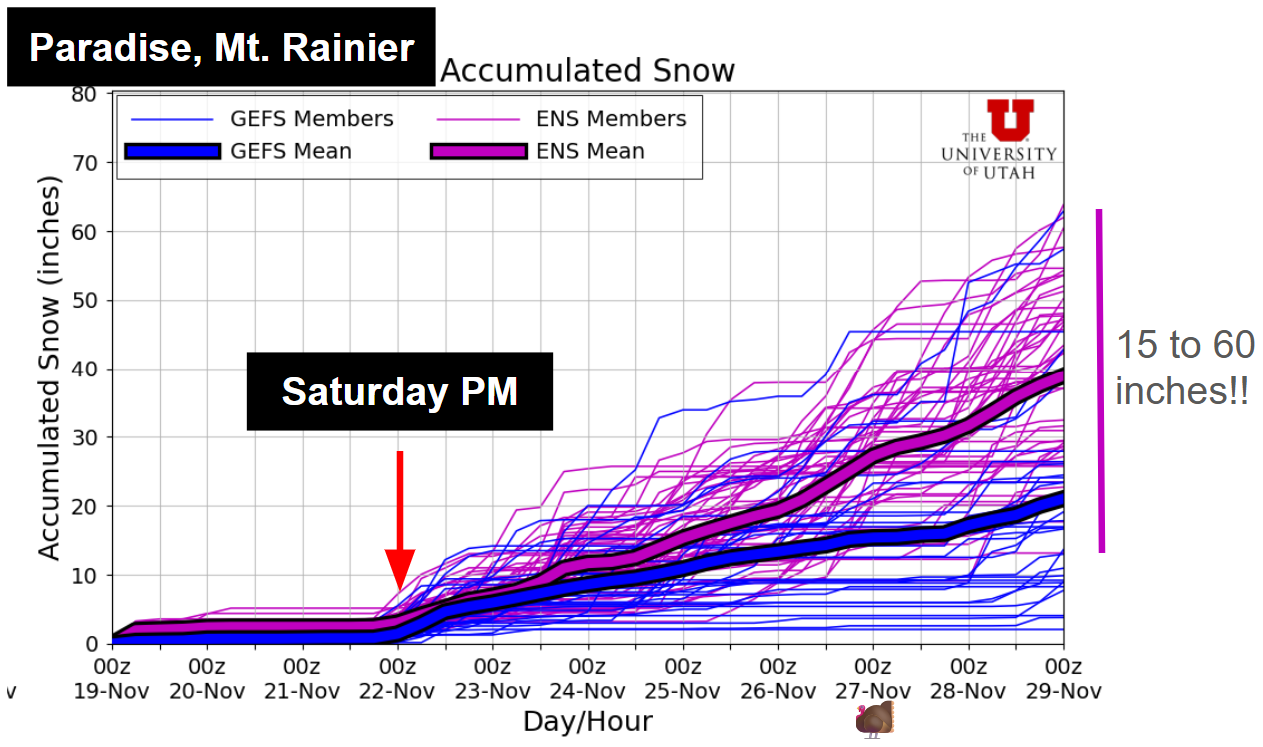
Another system arrives Monday, and models disagree. The GFS orients it so Washington gets almost nothing. The ECMWF is much wetter here, and the trend is toward the ECMWF. Cold air is in place with plenty of moisture available, so this is the one to watch. Even so, snow totals vary widely from ensemble member-to-ensemble member, with the ensembles at Paradise projecting between 15 and 60 inches of snow in the next week. The highest numbers are concentrated down south, but each ski region gets in on the action. Hopefully this can be a base building period and we won't have to hit the reset button again.
However, I will note that this is not a slam dunk set up. Even if we have good moisture support, if models trend towards warmer solutions, it won't be good for many of our ski areas. Here, we have to find the balance between cold air, moisture, and storm orientation to get solid accumulations everywhere. This setup leaves all three up in the air.
🧰 Related tools: Upper Air and Surface WeatherPrecipitation toolsFreezing & snow level
7. Long-Term Outlook
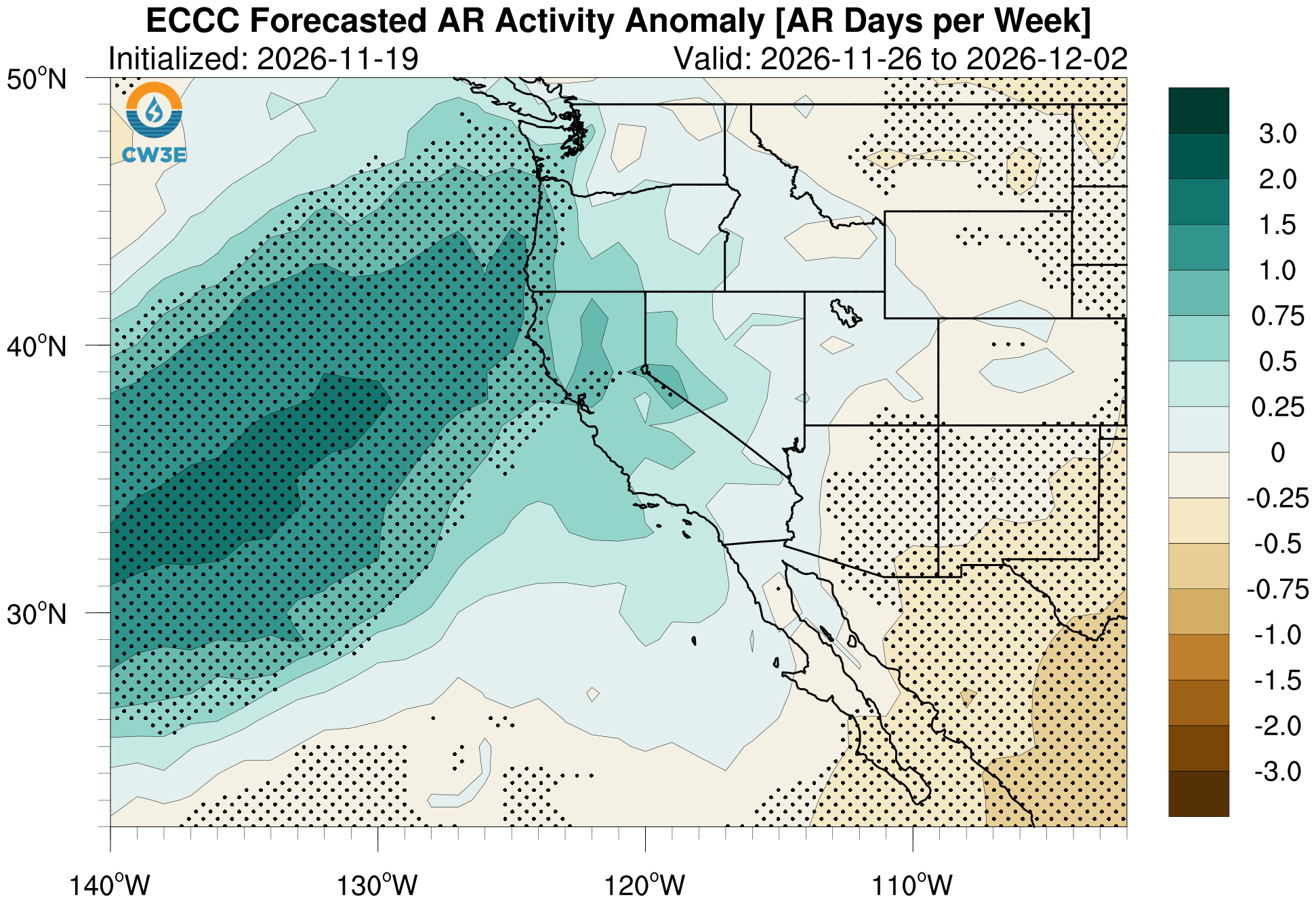
The outlook gets murkier. The ECMWF and CPC both point to a warm, wet pattern, typical of atmospheric river landfall. We’ll need the temperature anomalies to stay modest so more of that precipitation falls as snow.
- Weeks 2–3: Warmer and wetter than average. Just how much remains to be seen. Signals point to enhanced atmospheric river conditions.
- Signals to watch: Will the orientation of these big firehose storms allow for any cold air to seep in? Will temperatures stay modestly above normal, rather than too far above?
🧰 Related tools: Sub-seasonalSeasonalTeleconnectionsTea Leaves