
In this week's edition of the Dendritic Growth Zone Forecast Blog what's that?
Did you miss us? Just like the PNW's fall storms, CMW weekend forecasts are back!
🎯 The Short Version
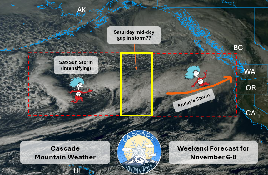
Welcome back to the CMW weekend forecast! We're stoked to have you. This weekend two back-to-back atmospheric rivers will impact western Washington starting early Friday. But a window of opportunity for some outdoor adventure still exists mid-day Saturday.
🛍️ New season, new gear! Check out the CMW merch store.
📑 Contents
1. Past Week Recap
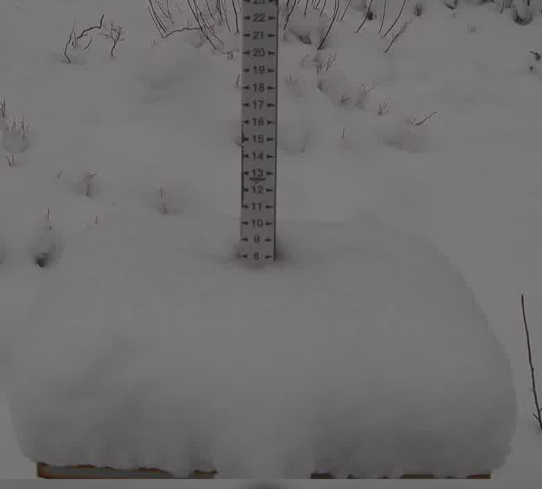
Last weekend's lovely fresh coating of early season snow will soon be a distant memory. As the closed low that brought the bundle of cold air descended south, a transient ridge developed overhead, giving us some nice fall days early in the week. A weak system spun through Wednesday as Gulf of Alaska troughing began to heat up.
🧰 Related tools: Live conditions mapSatellite loopForecast evaluation
2. Synoptic (Large-Scale) Overview
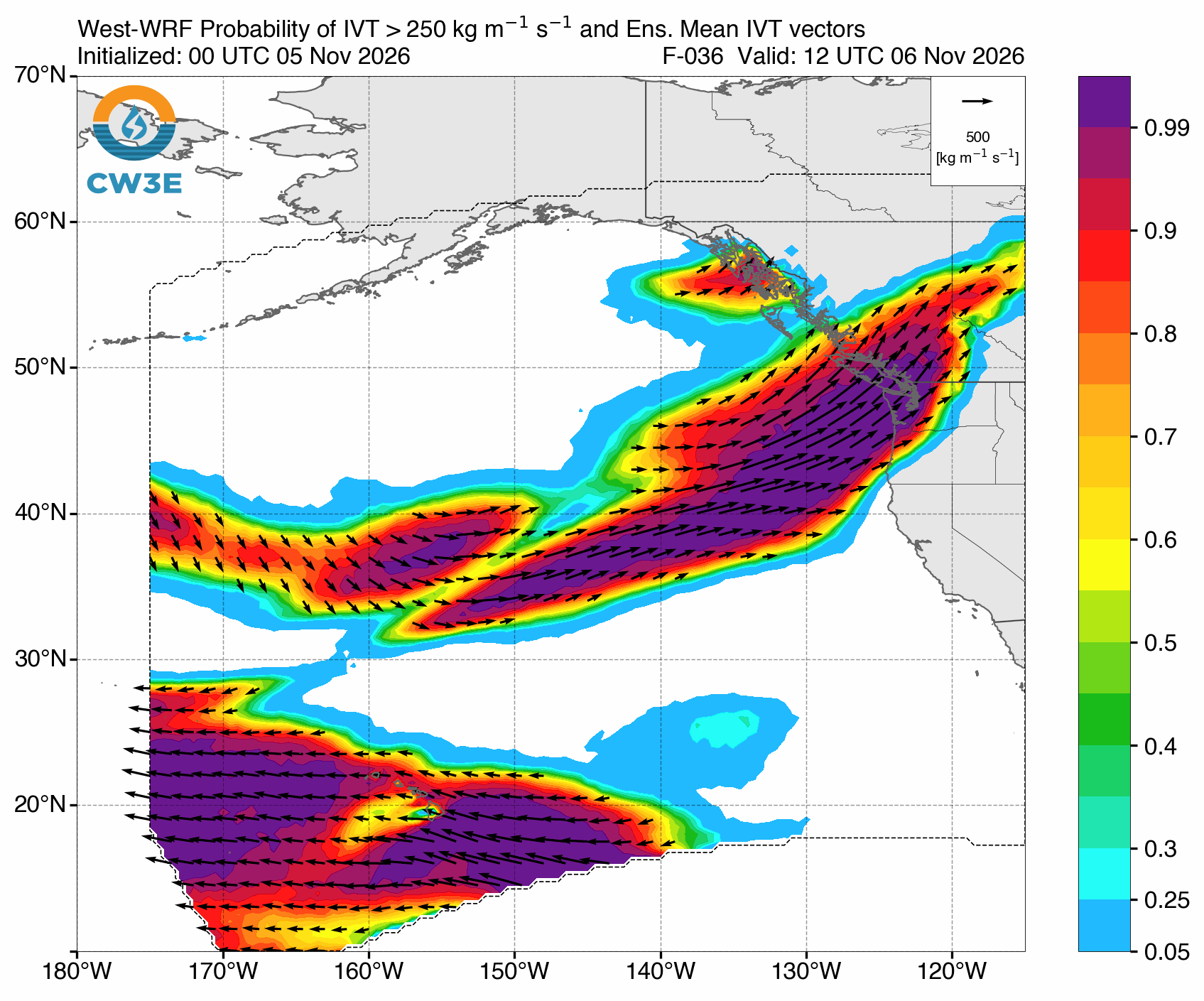
A strong atmospheric river is approaching from the southwest as of Thursday evening, accompanied by strong winds and high amounts of IVT (integrated vapor transport). IVT is a measure of the amount of water vapor in the atmosphere that is "flowing". You could think of it like the flow rate of a river.
- Pattern: Extratropical cyclone hitting northern BC ushers warm, moist air into the PNW.
- Key features this weekend: A one-two punch of ARs with a brief reprieve on Saturday.
- Model agreement: High confidence in the overall pattern and intensity, but timing is a bit uncertain as to when the second storm arrives.
🧰 Related tools: Upper Air and Surface WeatherSatellite loopSkew-T / soundings
3. Local Overview
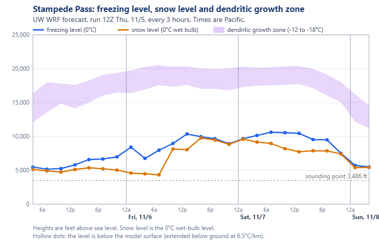
Precipitation with our first AR begins Thursday evening as a deep low slams into Northern BC. Friday will be very wet and mild with freezing levels increasing over the day. Precipitation from this first storm should taper off early Saturday, as the next storm intensifies over the Pacific. This one is not as strong and will usher in cooler air behind it as the center of this storm is much further south. For both these storms, northern regions are favored for higher totals.
- Friday: Rainy and warm pretty much all day, with temperatures rising to the low to mid 40s at 5000 feet. The most intense precipitation looks to be concentrated Friday afternoon.
- Saturday: Precipitation tapers off in the early morning hours. Sun breaks are possible further south. Temperatures will be mild. Precipitation picks up again towards the late evening.
- Sunday: Precipitation is concentrated overnight. Snowfall chances are possible throughout the day after freezing levels drop.
Freezing level & temperatures
Freezing levels rise through Friday and Saturday before beginning to drop Saturday night.
Winds
Strong winds are expected during Friday's early afternoon frontal passage. Winds will likely be higher further north.
Uncertainties
The timing of the most intense precipitation is still uncertain, but expect mid-afternoon Friday to bring the brunt of the storm.
🧰 Related tools: PrecipitationFreezing & snow levelLowland snowSkew-T / soundings
4. Preciptiation Forecast: Map, Plumes and Table
Click a location on the map (or its name below it) to see that site's snowfall and liquid precipitation plumes and its snow table. Sites are colored by their weekend total.
NBM 18Z, HRRR 18Z, RRFS 18Z, HRDPS 18Z Thu 5 Nov.
🧰 Related tools: Precipitation toolsFreezing & snow levelSki model meteograms
5. Weekend Winners (and Losers)
I'm classifying a winner this weekend as a place where a good dry window appears. But mud will be plentiful :).
🏆 Winners
- South of I-90: The storm will be more intense up north, pockets of sun and drier skies are more likely on Saturday.
🥀 Losers
- North of I-90: But if you like more mud and a bit more rain, get after it.
Best bet this weekend: Hiking/biking/running around mid-day on Saturday at low-mid elevations. But don't hate me if you get wet. You can't hit a home run if you don't take a swing!
6. Mid-Range (Early Next Week)
The atmospheric river train and Gulf of Alaska troughing continue as several more mild storms work our way. There is some model disagreement, with the Euro being more aggressive with the impact these storms would have for us.
🧰 Related tools: Upper Air and Surface WeatherPrecipitation toolsFreezing & snow level
7. Long-Term Outlook
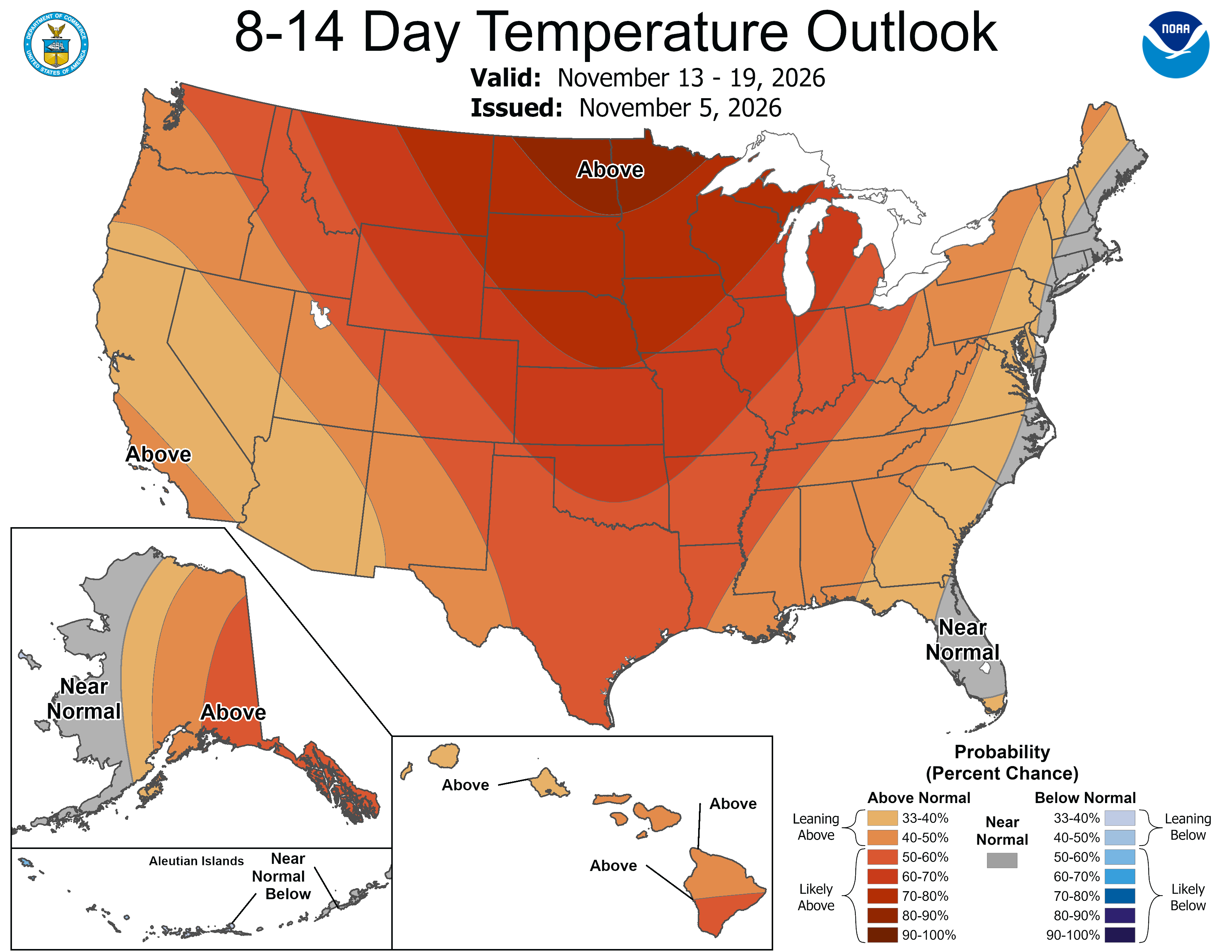
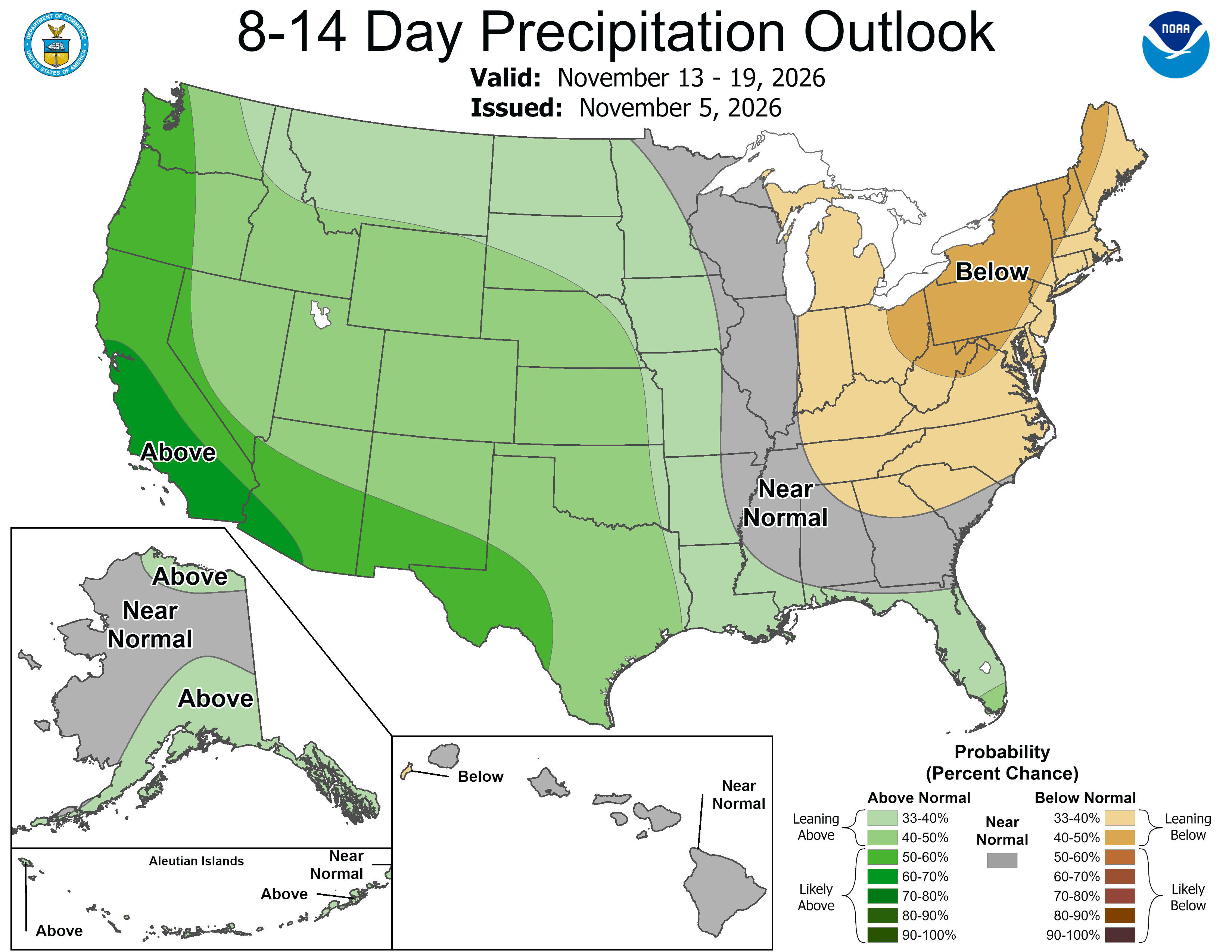
It looks like a mildly warm and wet pattern will continue for the foreseeable future. Both the ECMWF and CPC outlooks agree on slightly warmer temperatures and greater than normal precipitation over the next 2 weeks. Read that as: rain at most mountain locations. But hey, it's only November, right? (famous last words)
- Season context: We will discuss the implications of this year's "Super" El Niño in some follow up discussions, but what I can say for now is that we can be confident temperatures will be above normal. Precipitation is uncertain. However, if we get a few series of the right kind of storms, we could still end up alright. Though this is optimistic. At the very least, there will be some good days, as always.
🧰 Related tools: Sub-seasonalSeasonalTeleconnectionsTea Leaves